
X02 - The Lost History of Bourbon: The Birth of Bourbon
Listen to the Episode
Show Notes
From out of the wilds of Kentucke country a frontier region develops into a community. Little do these residents know, but their area will become famous for the whiskey it creates. Enjoy this special event as I continue to release the rough draft of my book The Lost History of Bourbon. Welcome to Chapter 2.
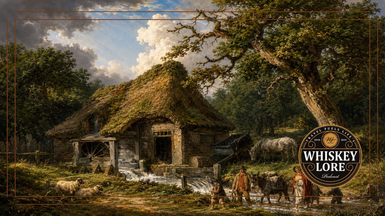
Painting is a recreation of George Morland - The Old Water Mill (1790)
Transcript
On a Tuesday afternoon in May, seven men gathered at Fairfield Estate, the home of Colonel James Garrard, his wife Elizabeth, and their seven children. They were tasked with forming a government and legal structure for Virginia's newest county. Once part of Fayette County, this newer county was still imposing in size-taking up nearly a fifth of the Judicial District of Kentucke. The setting inside the colonel's limestone home was awkward but necessary. Among the court's first responsibilities was recommending to the Virginia General Assembly a permanent county seat and a place where future sessions could be held.
With the colonel presiding, the first order of business was to administer the oaths to the justices. General John Edwards, a veteran of George Rogers Clark's campaigns and soon to be the county's first clerk of court, began the proceedings. He first administered the Oath of Fidelity to the Commonwealth to Colonel Garrard, then swore him in as the county's first Justice of the Peace. In turn James administered the oath to the six other justices, including his brother-in-law Alvin Mountjoy and early settler John Hinkston. Next came the assigning of officers with Colonel Benjamin Harrison, an early settler and war veteran from Westmoreland County, Pennsylvania, as the county’s first sheriff.
With the main players in the county government assigned, the second day focused on selecting leaders for the county's defense and the creation of a road to a proposed seat of government on the hillside overlooking Stoner and Houston creeks. Sheriff Harrison stressed the importance of picking a spot as the justices could try and convict people, but he wouldn't be holding any prisoners without a jail.
Of all of the decisions made during that first session, possibly the most critical to the economic success and stability of the county was the assignment of a county surveyor. In this man's hands was the ability to define boundaries, secure titles, and prevent bitter land disputes. His direction influenced the establishment of farms, roads, and community development. In the wrong hands, it could lead to intrigue and political favors. TFor the job, the seven justices would need to recommend to the governor a man of great integrity.
The man they chose, was 37 year old James Garrard.
A MAN FOR A NEW LAND
Raised on the Garrards Stafford County farm in Colonial Virginia, James seemed destined to follow in his father’s footsteps as a farmer and family man, taking his childhood sweetheart Elizabeth Mountjoy as his bride at age 20. But life changed quickly for the Garrard’s in 1775 after the first shots were fired at Lexington and Concord. James followed his father into the war on the American side, serving under his command in the Stafford County militia.
But he was more than just his father’s son. James harbored a passion for preaching the Gospel, becoming a Baptist minister. Under British control, this was not an easy life path to choose. The Anglican Church of England was the official religion of the colony and while dissenting faiths were allowed, they had to have licensed meeting houses. Itinerant evangelists, especially Baptists, often preached without those licenses, sometimes leading to their imprisonment. There was an irony in Garrard's struggle. His family traced its ancestry to French Huguenots, Protestants who had faced persecution under the Catholic Crown before many fled France for England. Generations later, their descendant was fighting religious restrictions imposed by the English establishment in Virginia. Inspired to action, James won a seat in the Virginia House of Delegates in 1779. During his session, newly installed Governor Thomas Jefferson introduced his bill to establish religious freedom. The fight for religious liberty would eventually draw some of Virginia's most prominent political figures, including Patrick Henry, James Madison, and a lobbyist for multiple Baptist associations—the Reverend Elijah Craig. While the 1779 bill didn’t pass, its text resurfaced again in 1786 when James Madison pushed for its passage as part of the Virginia Statute for Religious Freedom. That bill was an important precursor to the establishment of religious liberty protections in the First Amendment of the Constitution.
The following year, he was back in the militia, tasked with protecting plantations and homesteads along the Potomac from British raiding parties.It wasn't until French forces arrived in strength that fortunes in the region changed dramatically. First came the arrival of the French fleet under the command of Admiral de Grasse who engaged the British navy in the Chesapeake Bay. At the same time, the Marquis de Lafayette, a brilliant commander and trusted advisor to General George Washington, was tracking British General Lord Cornwallis' forces arriving from the south. When General Washington and the Comte de Rochambeau moved south through Virginia, the ensuing victory at Yorktown brought an end to the raids on the Potomac. While Garrard had been defending Virginia, George Rogers Clark's campaigns had been extending American influence into the Illinois Country. With hostilities winding down in the east, the western lands were becoming a more practical destination for families seeking new opportunities.
Moving his family west in 1783, James sought to establish roots, building his new home out of limestone on the banks of Stoner Creek. As a frontier home, Fairfield was an impressive structure, signalling the shift from frontier living to permanent settlement.
To help pave the future for his new community, James returned to the Virginia House of Delegates, this time as a representative of Fayette County. Named in honor of the Marquis, Fayette was one of the first three counties carved out of old Kentucke County in 1780.
At the time, it probably felt adequate for the population but by 1784, Kentucky experienced a nearly four-fold increase in population to over 30,000 in just two years. The area around Fairfield saw an influx of families heading into the area from Pennsylvania, Maryland, and Virginia seeking land. The old stockade system was fading away andfamilies with military land grants like the Garrards were establishing cabins further away from the old stations. This fertile region around Stoner, Houston, and Hinkston creeks began absorbing elements of the plantation system from the east, with land rapidly being cleared and cultivated by settlers and the people they enslaved. Not only was there a need for more surveys than Lexington could handle, road planning and security on the frontier were woefully inadequate.
To solve the problem, James wrote and introduced a bill to the Virginia General Assembly creating a new county out of the eastern portion of Fayette County. The bill was passed and the county became the seventh in the Judicial District of Kentucke. Some later accounts credit Garrard himself. What is certain is that Virginia's newest county would carry the name of the French royal house that had backed the American cause.
BOURBON
To most 21st century Americans, the name Bourbon is synonymous with one thing—whiskey. But its origins and influence date back well over a millennium.
The name originated in central France in the 10th century, where the territory surrounding Bourbon-l'Archambault became known as the Bourbonnais. Its medieval lords bore the title Sire de Bourbon. By 1589, Henry IV became the first Bourbon king of France. With interruptions, the dynasty would occupy the French throne until 1848.
The great expansion of the House of Bourbon's influence on North America came under the reign of King Louis XIV. In 1682, French explorer La Salle claimed the entire Mississippi River basin for the king. In Louis’ honor, he named it La Louisiane.
Then, in 1722, a French royal engineer named Adrien de Pauger laid out the streets of New Orleans, to help create a semblance of order in its design. For the streets, names were drawn from patron saints and individuals connected to French royal houses. There are several options suggested as to which member of the House of Bourbon inspired it, but Pauger left no record. Rue Bourbon became Calle de Borbón during Spanish rule in the later part of the 18th century, eventually becoming Bourbon Street after the Louisiana Purchase brought New Orleans into the United States.
With the status of the French elevated at the close of the Revolutionary War, and names like Louisville and Fayette directly influenced by French aid, choosing the House of Bourbon as the county's namesake was a sign of the times. As for its association with whiskey, that was still decades away.
SETTING THE FOUNDATION
As the Bourbon County Court met for its second session in June, the scene shifted to the new two-story stone built home of John Kiser. A family of Dutch Presbyterians, they settled in Germantown, Pennsylvania in 1688. In the late 1770s John and Ursula Kiser moved from Culpeper County, Virginia and made their first attempt at settling in Kentucky. By 1780 they reached Stoner Creek and constructed Kiser Station. An enterprising and industrious lot, John and his brother Jacob saw a great future for the county’s agricultural development. Plans were made to make a permanent settlement and they built their home off Cooper’s Run in 1785. Subsequent meetings occurred at Fairfield, Kiser’s home, and James Hutchinson’s home on Cooper’s Run until a permanent courthouse was built.
There were two areas under serious consideration. One was the site of Isaac Ruddell's homestead where Stoner and Hinkston Creeks flowed into the South Fork of the Licking River. The other location was near Joseph Houston's old station at Houston and Stoner creeks. According to oral tradition, the Ruddell’s site wasn’t under consideration for long, as Isaac's wife Elizabeth opposed the idea—fearing people would rob their peach and apple orchard when they came to court. Eventually the Stoner and Houston creek location won out. Some called the town Bourbonton, but once its primary landowner Lawrence Protzman platted a grid of lots and streets, it was named Hopewell after Protzman's hometown in New Jersey, The town wouldn’t be officially chartered until 1789. As for the courthouse, in anticipation of its erection, the August 1787 court was held outside on the proposed site. Two months later, the simple 32’ by 20’ log built structure went into operation.
By then, a strong plan for the development of Bourbon County was in place. The justices were given individual zones throughout the county and were charged with gathering names of large land owners for taxation purposes. With the hopes of developing economic trade and opportunity between communities and the main path between Lexington and Limestone Landing, a network of roads was discussed that connected the Millers, Ruddells, Swinneys, and others.
With increased confidence in the security of the road between Lexington and Limestone Landing—now being referred to as the Port of Kentucke—more travelers were anticipated in the area. Taverns became a necessary part of the county infrastructure and since 1705, Virginia required taverns and ordinaries to be licensed and rates set by the local government. These establishments came in various shapes and sizes. Some served as inns, providing entertainment, drinks, lodging for weary travelers, a cold or hot meal, and stabling and hay for horses. Others became gathering places for conversations and libations. The quality of taverns ranged wildly on the frontier. ***The state hoped to regulate them to not only prevent keepers from gouging customers, but also to keep them from attracting the wrong type of clientele.
Bourbon County’s first rates as follows were established during the second session at John Kiser’s house:
West India Rum (24 shillings per gallon)
Continent Rum (15 shillings per gallon)
Brandy (15 shillings per gallon)
Whiskey (10 shillings per gallon)
Wine (24 shillings per gallon)
A Warm Dinner (1 shilling 6 pence)
A cold dinner (1 shilling)
Breakfast with tea, coffee, or chocolate (1 shilling and 3 pence)
Breakfast without tea, coffee, or chocolate (1 shilling)
Corn for horses (6 pence per gallon)
Pasturage for 24-hours (6 pence)
Stablage and hay or fodder (1 shilling)
Lodging in clean sheets (6 pence)
There are several curious items within this pricing scheme.
First, was the use of the shillings as the denomination of choice. Based on the old British system of Pounds, Shillings, and Pence it was the most universal way of understanding value at the time. The reality was, most travelers didn’t carry this type of currency. Instead, tavern owners converted bartered items like tobacco, pork, whiskey, or labor into the estimated currency value. If coins were used, the Spanish milled dollar was the most trusted coin—the Continental currency had badly depreciated during the war, a problem worsened by British counterfeiting.
The second curiosity is in, not only the value of the spirits listed, but in the appearance of whiskey in the Bourbon County record. One might be quick to assume the whiskey sold at the tavern came from local distillers. But the record doesn't tell us where that whiskey came from. Some may have been locally distilled, while some could have arrived with travelers or merchants from Limestone or Lexington. Why it cost less than rum, brandy, and wine is open to speculation. Was whiskey simply easier to obtain, of lower quality, or had it not yet earned favor with frontier patrons?
With the county infrastructure in full development, James Garrard, John Kiser, and others had their eye firmly planted on the future. But reminders kept surfacing that the old world of Indian raids and devastation were not completely gone.
Escalating violence between tribes and settlers along the Wabash River spilled over into open conflict. In response, General George Rogers Clark raised an army of nearly 1,200 men to put down the uprising. John Miller was conscripted into the force, given the rank of major, and paid five pounds sterling and ten shillings for his service. Other notable Bourbonites including Private Samuel Clay and soon to be Hopewell tavern owner Thomas West fought alongside him. And the violence wasn't confined to distant campaigns along the Wabash. It soon struck close to the Kisers' home on Cooper's Run. In 1788, warriors attacked the home of the widow Shanks, killing five family members and abducting one of their daughters, who they later scalped.
The Shanks attack demonstrated the vulnerability of isolated farms. Stations offered protection, but their small footprint did little to create the security needed for farms and communities to spread out between them. A larger, more interconnected population would bring roads, commerce, and mutual defense while steadily extending settler control over the countryside. To achieve the goal of community building, Bourbon County didn't need to reinvent the wheel. A century earlier, Virginia's colonial government already created the blueprint.
MILL FEVER
Mill Fever
In 1667, Virginia's frontier was still well east of the Allegheny Mountains, and development of the inland economy was slow.
With plenty of fertile farm land available, growing grains was the natural choice. Yet, at the time, most grain was ground by handmills that required intensive labor with limited output. Horse and mule driven mills were an answer, but watermills held the most promise. However, they came with a lot of logistical and legal issues.
To solve these issues, the colonial government passed the Virginia Mill Act. An early eminent domain law, it created a legal framework for settlers to build dams and water-powered gristmills on non-navigable streams. To save on lawsuits, it also provided compensation to other land owners whose farms might be flooded by the inclusion of a dam. County courts issued writs of view/condemnation to assess potential damage before issuing permits for construction. For the colony, the increase in mills diversified agriculture, increased grain output, and as a side benefit, they created a permanent infrastructure that anchored settlers to the area. More farms meant less hunting grounds, dams meant less fishing opportunities, and more farmers meant better defense.
In turn, the farmers loved the mills. Milling was intense work. Poor farmers or pioneer settlers used a pestle to physically pound and grind grain in a bowl called a mortar. It required several hours of intensive work just to produce enough for a daily supply of johnnycakes and cornbread. Hand mills like rotary querns or mechanical crank mills reduced the labor, but the machines themselves could be expensive. To get away from hand processing, if farmers had a small creek available, they might build a simple shack and install a tub mill inside. These smaller operations contained a mini-wooden horizontal wheel inside a tub. The force of water turned the wheel and thus the millstone which ground the grain. While easier on the muscles, this still required a great amount of time for little output. Some farms were big enough to construct their own horse, ox, or mule mills. In this setup, the miller hitched a horse or ox to a sweep. The animal’s power combined with torque to turn the millstone. It still required a healthy animal to remain in service. The larger scale mill solved both the physical challenges and water needs. They only required the transportation of grain to the facility and the time it took to run it through a much larger and efficient apparatus.
For the government’s purposes, the watermill was the ideal solution. Yet for the frontier entrepreneur watermills not only required a quality water source, it needed significant capital investment. The most important factor was hiring a good millwright. They helped determine a mill's location, called a mill seat, by looking at geological, topographical, and hydrological factors. The creek needed to be able to generate enough waterpower to keep the mill running continuously. Quiet streams were less useful than creeks on sloping hills. A ford (or low point in the creek) was handy to have nearby, to save on building structures across the creek. There was also consideration for neighbors, as the daming of water usually meant a flooding of someone else’s property. It is this point that the Virginia Mill Act sought to address. The Bourbon County Court went a step further prohibiting any "damage to houses, orchards, or fields...stagnation of water," or "prevention of the passage of fish." Yet with all the financial and legal drawbacks, mills were lucrative to those who got in early—especially in a bartering economy, making them worth the risk. To lessen the legal risks, the government allowed a landowner to petition the court if they needed to purchase part of a neighbor’s property to complete the job. Seen as a benefit to the public welfare, it was granted legal leeway ***They also gave millers legal immunity to a neighbor’s flooding claims. To stop abuse of eminent domain, a mill had to be constructed within three years or the neighbor could petition the court to return the land to build their own mill. Another financial incentive came in the form of a toll system. In a mostly cashless society, millers were allowed to charge a fixed toll of one-eight of the grain for Indian corn and one-sixteenth for wheat for any grain they processed. For a busy miller, those tolls could quickly create a surplus of grain. Add a still to the operation, and that surplus had another potential use.
With all of these incentives and a local government established, Bourbon County experienced a great boom in the building of mills in 1787. Up to that time, the only substantial mill in the area was said to be that of John Hinkston. During the summer, notable Bourbon County residents including James Garrard, James Hutchinson, Isaac Ruddle, Alvin Mountjoy, John Edwards, Laban Shipp, and William Miller all petitioned to erect mills.
According to Needham Parry, who wrote a journal of his 1794 adventures in Kentucky, William Miller built a grist mill for grain production and a fulling mill for cloth production just past a ford and dam on Hinkston Creek. On the other side stood his brother John Miller’s grist mill and saw mill. While their initial mills were thought to be smaller, their early arrival in milling afforded them the financial opportunity to expand. Other millers took advantage of the diversity of mill-types to get in on the act. Mills were used to press apples into cider, grind tobacco into snuff, saw lumber and barrel staves, process wheat into flour, and produce gunpowder for protection.
Community gristmills quickly became the center of commerce, where local farmers brought their grains to be ground into productive grist, cornmeal, and flour. With larger plantations developing, private watermills allowed landowners to mill their own corn, wheat, rye, oats, and barley while profiting off a choice number of neighbors.
In areas without an established tavern nearby, community gristmills also became social centers. As farmers traveled to nearby mills for grinding their corn they found themselves waiting their turn. These waits turned into the sharing of news, gossip, creative agricultural ideas, and sometimes led to distractions. The Cooper’s Run Church, where James Garrard sometimes preached, condemned the mills as a "place of rendezvous for card players." They also were a prime candidate as suppliers of that 10 shilling per gallon whiskey. And where grain, commerce, and idle farmers gathered in one place, whiskey was unlikely to remain far away.